
Services Surveying & Mapping
Surveying & Mapping Services
- Boundary Surveys
- Topographic Surveys
- Record (as-built) Surveys
- Utility and Infrastructure Layout
- Global Positioning System Surveys
- Route Surveys for Engineering Design
- Condominium Document Preparation
- Platting Services
- Right-of-Way Mapping
- Annexation Maps
- Sketch & Legal Descriptions
Survey Smarter, Build Better

End-to-end service
We provide a consistent project approach from initial request, project research, compiling a definitive scope of services, communication, QA\QC, and final product deliverable.

Advanced technology
As the surveying profession has advanced in both technology and education, SAFEbuilt has invested in some of the most state-of-the-art surveying equipment available.

Constant communication
We believe in constant communication, not only with our clients but communication between field crews and office personnel. This communication is allows us to complete your survey in the most efficient manner possible and enables a quick resolution if any surveying issues arise.
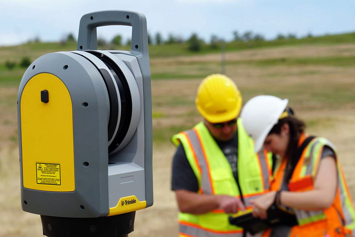
Accurate, three-dimensional snapshots
Our Trimble X7 takes a virtual snapshot of a site with a level of detail that previously would have taken significantly more field and office resources.
By collecting millions of data points in a 360° horizontal and 270° vertical field of view, field crews can survey a site once and have a permanent record of all the visible items on file.

Safe, quality assessments
Because our scanner is not dependent on traditional surveying methods of data collection, projects that would have safety issues such as high-volume intersections, electrical substations, or active construction sites can be collected without field personnel in unsafe working conditions.

Rapid download into GIS databases
Using Trimble Real Time Kinematic (RTK) GPS equipment with BlueTooth wireless technology and tied into the Florida Continuously Operating Reference Stations (CORS) allows us to collect vast amounts of data referenced to the latest horizontal and vertical datums as established by the National Geodetic Survey Department (NGS).
Our IT department works in conjunction with the GIS and Survey departments to set up protocols that enable data transfer and database entry from remote locations seamlessly. Issues that plague large GIS\Survey projects regarding incompatibility between field and office, software application to software application are non-existent with our team.
With a full-scale GIS department providing data population and application development for a number of government entities, the survey department has developed capabilities to provide efficient field data collection for rapid download into GIS databases.